You come to Isle of Palms for the water, but every shoreline lives differently. Oceanfront, deepwater, creekfront, and canal lots each offer their own rhythm, access, and responsibilities. If you are weighing a trophy beachfront setting against protected harbor access for a larger boat, knowing the practical differences will save you time and help you focus on the right parcels. In this guide, you will learn how each waterfront type functions on Isle of Palms, what to expect for dock feasibility and permitting, and the due diligence steps that matter for high‑value purchases. Let’s dive in.
Isle of Palms waterfront at a glance
Isle of Palms is a barrier island with two distinct water environments. You have the Atlantic beach and dune system on the ocean side, and the Intracoastal Waterway with tidal creeks, marshes, and engineered canals on the back side. This setting shapes access, dock potential, and construction standards.
Barrier‑island realities affect all lot types. Tides and daily tidal range influence water depth at your property. Coastal storms and hurricanes bring wind, waves, storm surge, and erosion risk. Marsh and wetlands introduce additional environmental rules on the back‑bay side. On the oceanfront, ongoing beach nourishment and dune management can influence how parcels are used over time.
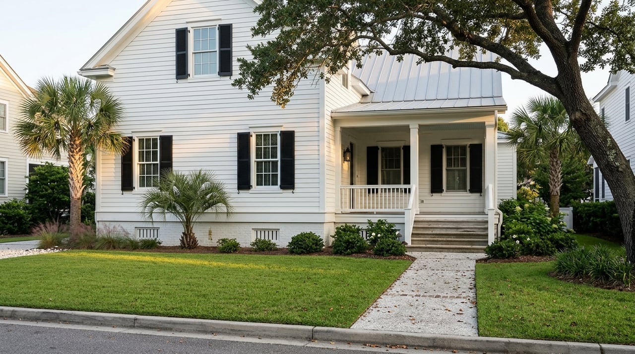
Oceanfront: pure beachfront living
Access and daily use
Oceanfront parcels front the Atlantic beach or dunes with unobstructed views and direct sand access. The primary amenity is beach life, with walkovers to the public beach in many locations and straightforward island road access.
Dock potential
Traditional private boat docks on the open ocean are not practical. Wave energy, surf conditions, and coastal rules typically prevent private ocean‑side docks. Boat access usually happens from marinas, the Intracoastal, or routes through inlets.
Lifestyle fit
Choose oceanfront if the beach is your focus. Expect elevated construction standards, higher exposure to storms, and insurance that reflects the location. Beach nourishment and dune protection programs may shape what you can do near the shoreline.
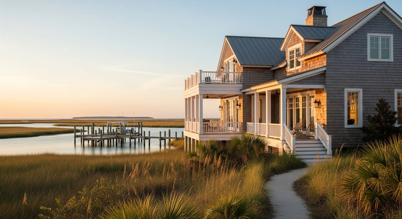
Intracoastal and deepwater: harbor access
Access and navigation
Intracoastal and other naturally deeper channel frontages give you year‑round, protected navigation to Charleston Harbor and inlet passages to the ocean. This is the most flexible boating setup for frequent use.
Dock potential
Dock feasibility is typically high. Private piers, bulkheads, and multi‑slip layouts are common, subject to permitting, water depth at mean low water, tidal range, and headroom under bridges along your route. Water maintained by federal or state channels can help sustain depth to your property.
Vessel types and use
Center consoles, sport boats, and motor yachts can be appropriate depending on depth and clearance. This setting is ideal if you plan to keep a boat at your residence and move easily between your dock, harbor destinations, and offshore opportunities.
Lifestyle fit
If time on the water is central to your routine, deepwater checks the box. It supports provisioning by water, simple harbor runs, and private slips for larger vessels.
Creekfront: quiet tidal channels
Access and setting
Creekfront lots border smaller tidal channels that weave through marsh. They are more sheltered and scenic, with depth that varies by tide and season.
Dock potential
Private docks are often feasible but typically serve shallow‑draft vessels. Floating docks and slender pile designs are common. Vegetation, tidal flats, or oyster beds can limit usable channel width, so a site‑specific survey matters.
Vessel types and use
Kayaks, paddleboards, flats boats, and smaller center consoles fit best. You get privacy, wildlife viewing, and good access for fishing with less exposure to wave action than the oceanfront.
Canal lots: planned water access
Access and network
Canal parcels sit on engineered waterways that often connect to larger channels or the Intracoastal. Many are in planned communities, including resort areas on the island, where the canal network was designed for residential boating.
Dock potential
Feasibility varies with the canal’s original design and ongoing maintenance. Many canals support finger piers and floating slips. Depth depends on historical dredging and any current maintenance obligations by the developer or the homeowners association.
Community considerations
Expect HOA rules and shared responsibilities for canal upkeep. Well‑maintained canals that sustain reliable depth support a broader range of boats and typically command stronger values.
Dock feasibility checklist
Before assuming a dock is workable, verify the basics. A waterfront parcel’s dock potential is always site‑specific.
- Bathymetric survey showing depth at mean low water in front of the parcel.
- Location of tidal flats, oyster beds, and vegetation that could affect alignment.
- Proximity to maintained channels that help keep water deep near the property.
- Bridge clearances and any overhead lines on your route to open water.
- Shoreline type, such as natural marsh, riprap, or prior bulkhead.
- Local history of shoaling or dredging needs at the site.
Permitting and agencies
Building on coastal water involves multiple approvals. The process and timeline vary with location and sensitivity of the site.
- FEMA Flood Insurance Rate Maps and Base Flood Elevations inform building elevation and insurance.
- Charleston County GIS and the City of Isle of Palms provide parcel records, zoning, and ordinances.
- South Carolina DHEC’s Office of Ocean and Coastal Resource Management oversees coastal permits and state submerged lands.
- The U.S. Army Corps of Engineers, Charleston District, handles federal permits for work in navigable waters and wetlands.
- NOAA charts and tidal data help evaluate navigation and channel locations.
- South Carolina Department of Natural Resources informs shellfish closures and marine resource considerations.
Typical permit sequence
- Order a certified survey and site plan that shows mean high water, property lines, structures, and topography.
- Confirm state and federal jurisdiction for wetlands or submerged lands and consider a pre‑application check with the state and the Corps.
- Prepare and submit joint permit applications, often with a marine contractor or permit specialist.
- If the parcel fronts a canal with HOA oversight, secure association approvals and clarify dredging or maintenance responsibilities.
- Obtain local building permits and coordinate with utilities for any construction impacts.
Timelines and costs
Straightforward private piers in less sensitive areas can move faster. Projects near wetlands or that require federal approvals and mitigation can take many months. If dredging is needed to achieve depth at mean low water, plan for meaningful costs and future maintenance.
Risk, insurance, and resilience
Isle of Palms sits in a high‑hazard coastal zone. Flood insurance is required for federally backed loans, and many buyers also secure private flood and wind policies. Large bespoke homes and private docks can add underwriting complexity, so specialty markets are common for ultra‑high‑value coverage.
Construction standards follow coastal codes. Elevated foundations on pilings, flood‑resistant materials, and structural systems that absorb wave action are the norm. The right design choices can improve resilience and long‑term ownership experience.
Utilities, access, and operations
Most island parcels connect to municipal water and sewer, though some edge properties may rely on septic or pump stations. Confirm service during due diligence. Evaluate power reliability and consider standby generators or battery systems. Review access roads and evacuation planning, which matter for both routine use and storm readiness.
Ongoing operations also deserve attention. Shoreline maintenance, dune restoration assessments, dock inspections, and bulkhead repairs are part of ownership. In canal settings, look at the maintenance record and any HOA assessments tied to dredging.
Valuation drivers by water type
Values reflect both the experience and the utility each shoreline provides.
- Oceanfront: Highest premiums for beach frontage and unobstructed ocean views, with sensitivity to dune stability, shoreline trends, and insurance costs.
- Intracoastal and deepwater: Strong premiums for private slips and direct harbor access, often second only to oceanfront depending on dock utility.
- Creekfront: Sought for privacy and scenery, typically priced below deepwater and oceanfront, popular with nature‑focused buyers.
- Canal: Dependent on canal depth, HOA governance, and maintenance history. Stronger values in canals with reliable depth and well‑managed infrastructure.
Buyer due diligence steps
For high‑value waterfront, a structured review protects your investment and informs design.
- ALTA/NSPS survey, FEMA flood map review, and elevation determination.
- Recent topographic or LiDAR data, bathymetric survey if you plan a dock, and shoreline change history.
- Full title review of easements, tidal access rights, and any recorded covenants or HOA documents.
- Permit history for docks, bulkheads, beach or shoreline work.
- Environmental constraints, including wetlands delineations and relevant habitat considerations.
- Local zoning consultation to confirm the buildable envelope and setbacks.
- Insurance market check for flood, wind, and liability coverage to estimate premiums.
- Planning for marina berth options if a private dock is not feasible for your vessel size.
- Structural inspections for any existing shoreline armoring, piles, and docks.
Smart questions to ask early
- Where is the mean high water line relative to the deeded boundary?
- Are there public access easements or utility rights of way across the parcel?
- What are the current flood zone and Base Flood Elevation?
- Has the site ever received a dock or seawall permit, and are drawings available?
- Do HOA covenants limit dock designs or assign dredging responsibilities?
- What shoreline projects have occurred nearby, such as renourishment or dune restoration?
How Robertson Allen can help
Selecting the right waterfront on Isle of Palms is about aligning your lifestyle and vessel needs with a parcel’s physical and regulatory reality. You get there fastest with local knowledge, a clear read on permitting, and disciplined due diligence. As a local steward and trusted advisor, we coordinate the right coastal engineer, surveyor, and permit team, frame value and risk clearly, and negotiate with precision so you buy with confidence.
If you are exploring oceanfront, deepwater, creekfront, or canal opportunities, connect with us to map the options and move decisively. Schedule a private market consultation with Robertson Allen.
FAQs
What defines oceanfront on Isle of Palms?
- Parcels that front the Atlantic beach or dune system with direct ocean exposure and unobstructed views.
How do deepwater lots differ from creekfront?
- Deepwater fronts the Intracoastal or naturally deep channels for larger boats, while creekfront borders shallower, meandering tidal creeks suited to shallow‑draft craft.
Can I build a private dock on the ocean side?
- Traditional private docks are generally not practical on the open ocean due to wave energy, erosion, and coastal rules.
What permits are needed for a new dock?
- Expect local approvals plus state coastal permits and federal review for work in navigable waters or wetlands, often filed as a joint application.
How long does dock permitting take?
- Timelines vary widely, with simple piers moving faster and projects near wetlands or requiring federal approvals taking many months.
What drives value across water types?
- Ocean frontage and views, deepwater dock utility and harbor access, creekfront privacy and scenery, and canal depth with strong HOA maintenance records.